Distance Learning Module 14 - Helmand River and Hari Rud-Murghab Hydropower and Irrigation
-
The Helmand River Basin in Afghanistan is 43% of the total surface area in the country.
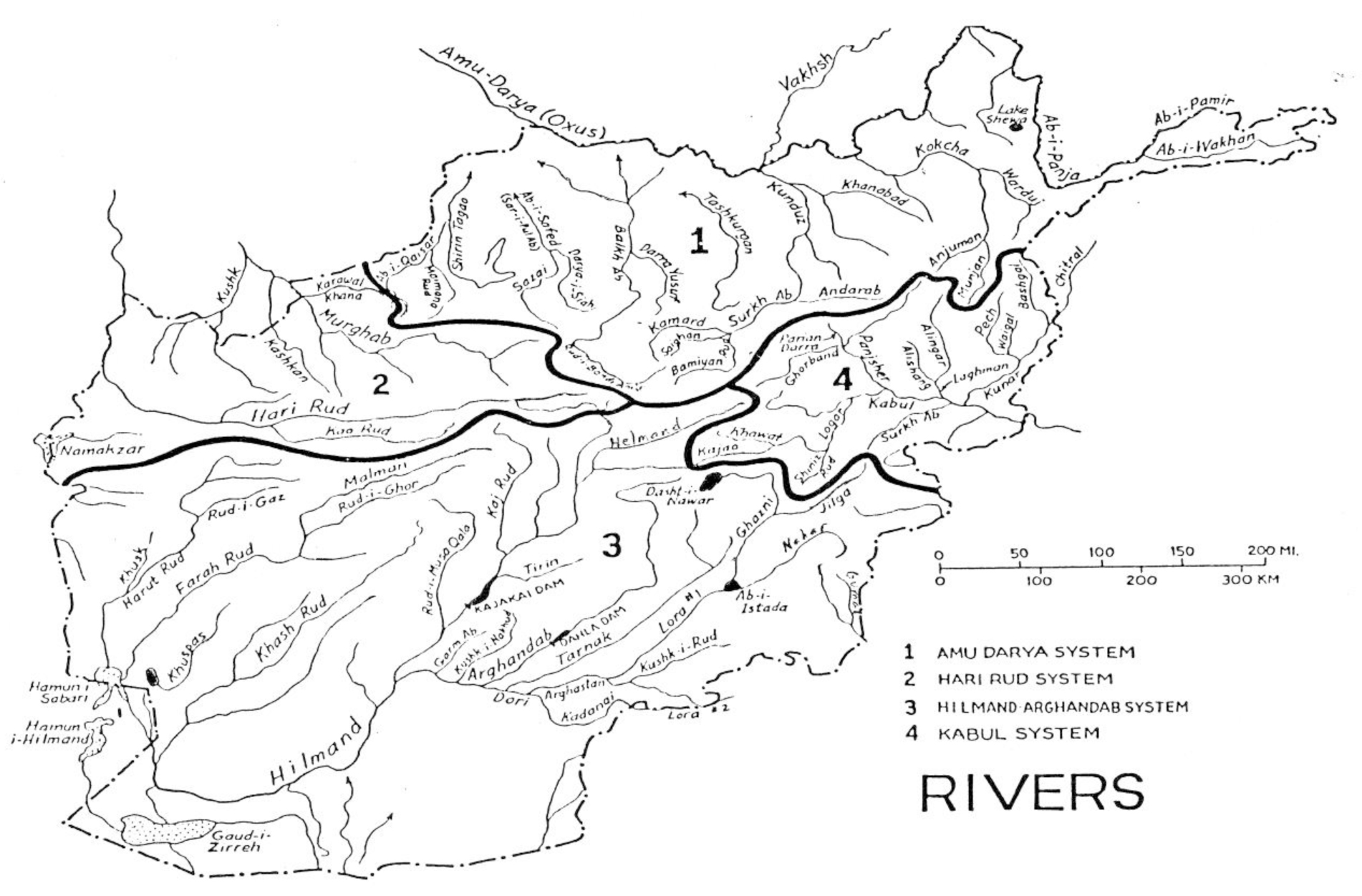
Figure 14.1. Drainage map of Afghanistan showing Helmand River basin as Number 3, and Hari Rud and Murghab as Number 2).
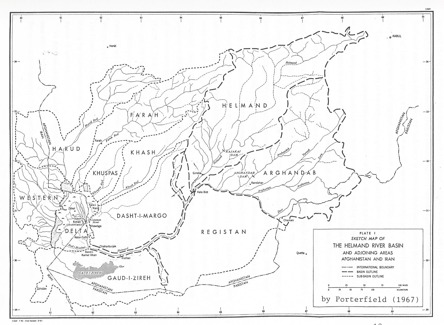
Figure 14.2. Details of the Helmand River basin.
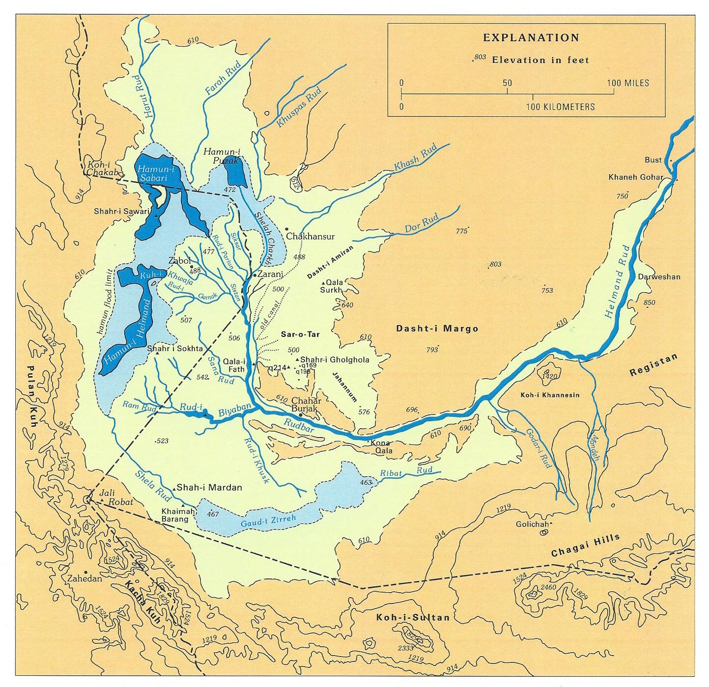
Figure 14.3. Map of southwestern Afghanistan showing inland delta of the Helmand River where it empties into the huge (~300 km long) Seistan Basin depression (light yellow), and the deeper hamoon basins (light blue & dark blue). Gaudi Zirreh is the lowest altitude part of the region and in wet years can receive water overflow from the hamoons on the border between Afghanistan and Iran, before the last of the water flows back into Afghanistan and into the lowest Gaudi Zirreh.
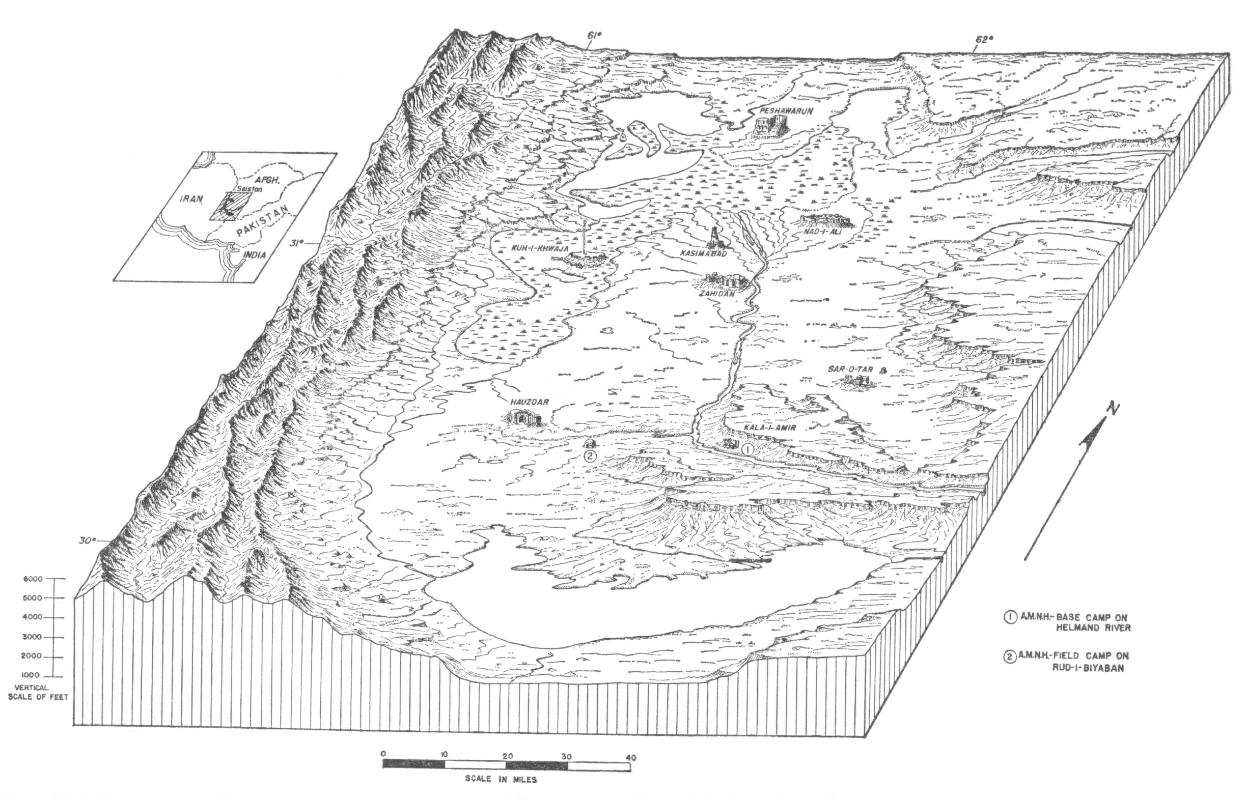
Figure 14.4. Cartoon perspective drawing of the Helmand River delta area showing how the water flows in a counter-clockwise direction before finally ending into broad Gaudi Zirreh depression in the foreground.
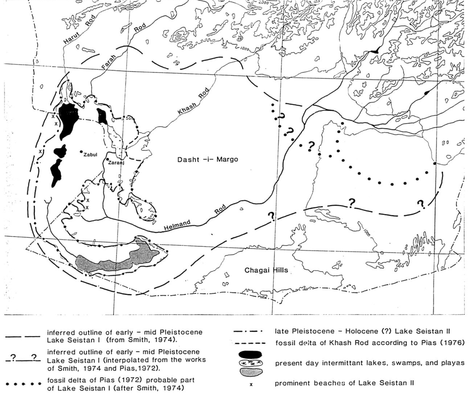
Figure 14.5. Map of lower Helmand region showing progressive retreat of Lake Seistan from a once much bigger size thousands of years ago. The largest lake is unrealistic but the Lake Seistan II noted as being of late Pleistocene - Holocene (?) is much more realistic because thousands of years ago, large villages or cities were located all around it.
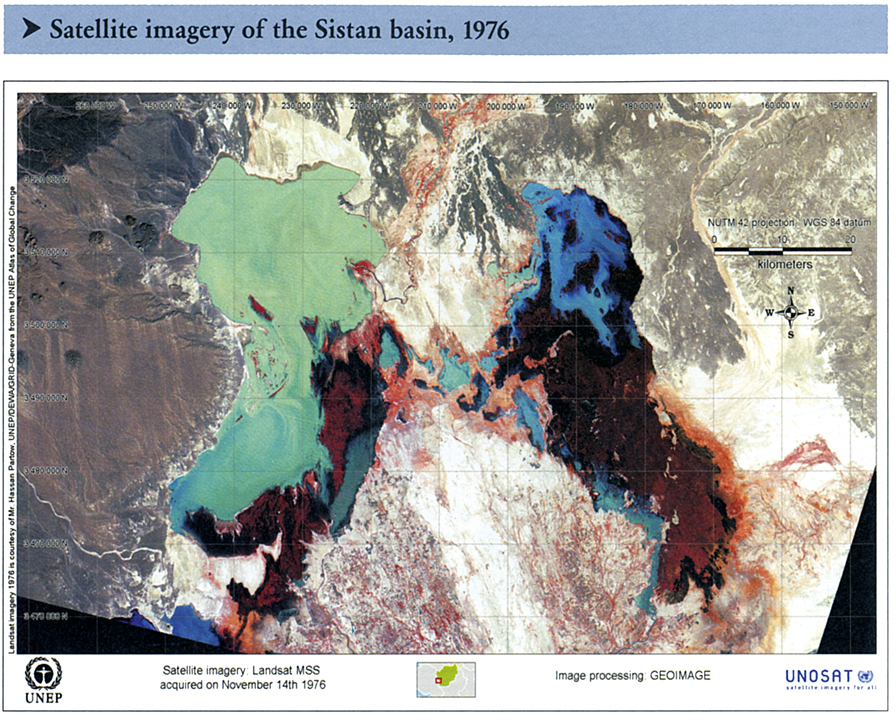
Figure 14.6A. Satelite imagery of the Sistan basin 1976.
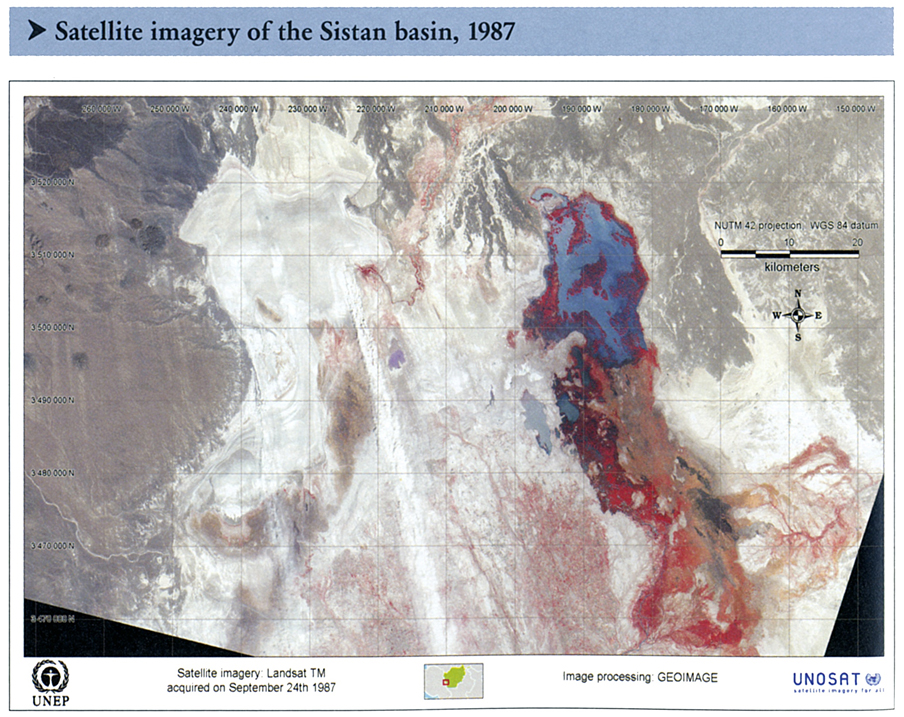
Figure 14.6B. Satellite imagery of the Sistan basin 1987.
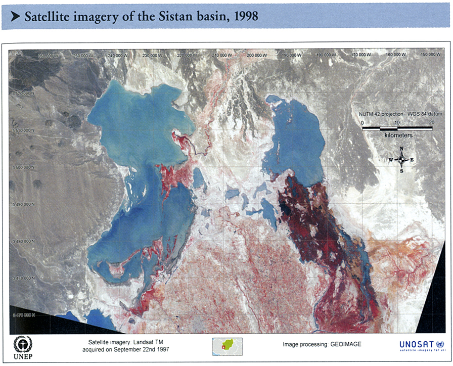
Figure 14.6C. Satellite imagery of the Sistan basin 1998.
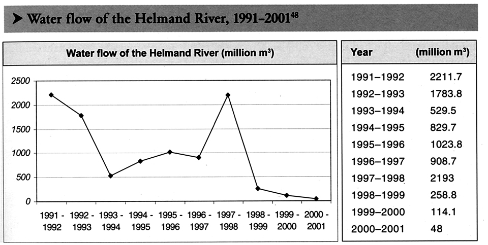
Figure 14.6D1. Water flow in the Helmand 1998 – 2001.
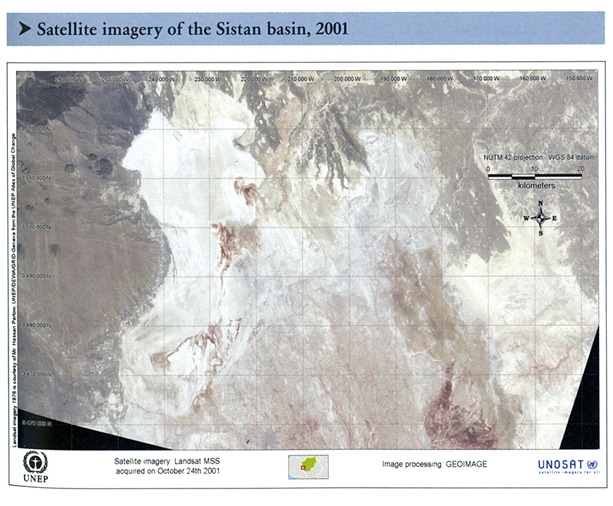
Figure 14.6D2. Satellite imagery of the Sistan basin 2001.
- The Harirud – Murghab river basins together cover about 18% of the surface area.
- The Helmand River has an average annual water flow of about 9.3 billion cubic meters (BCM), or 9.3 cubic kilometers (km3), which is only 11% of the average annual flow in the country.
- The Harirud – Murghab rivers together have about 3 bcm (3 km3) or 4 % of the total flow in the country each year.
- The lower Helmand River itself dried up entirely in the 2001 drought so that the hamoon (ephemeral lakes) also dried up and were extensive sources of dust that was blown to the south and southeast in the strong winds of the spring and summer months (Wind of 120 days).
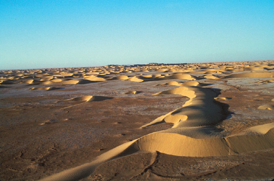
Figure 14.7. Jehanoum dunes derived by high winds (Wind of 120 days) and deflation of sandy sediment brought down by Helmand River and deposited in the Helmand Delta. Lake Seistan II was at about the height of the highest ground in the background.
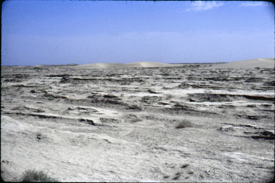
Figure 14.8. Strong deflation by Wind of 120 days deflates (erodes) sediments and carries it away.
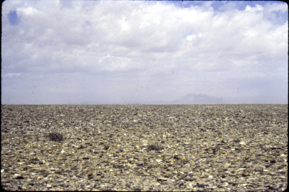
Figure 14.9. Deflation of lake sediment leaves behind gravel in the Dashti Margo (Desert of Death).
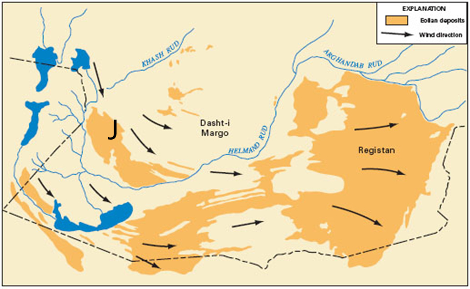
Figure 14.10. Map of wind-blown sand in the Sesitan Depression. Arrows show wind directions that move the sand in dunes. J indicates location of dunes of Jehanoum.
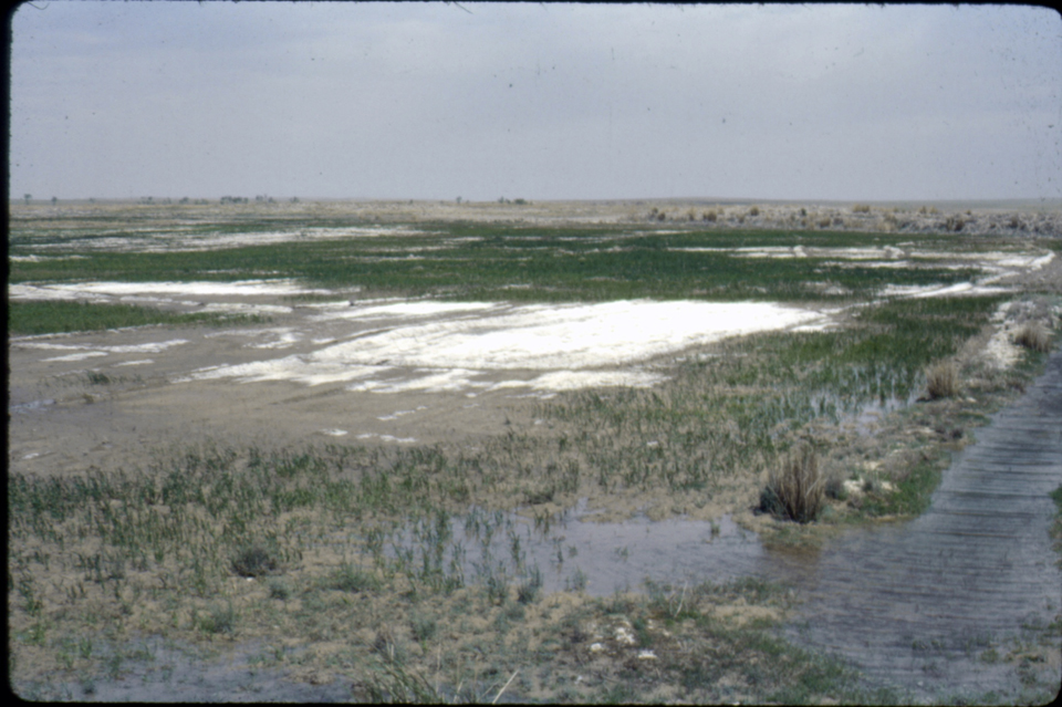
Figure 14.11. Salinization buildup of salts through irrigation in lower Helmand and water logging as the water does not drain away because of subsurface layers of impermeable soils that do not allow water to pass through them.
- The Helmand River is a vital source of irrigation water that has been used in Afghanistan for many decades, especially over the past 50 years.
- The average annual water discharge of the Hari Rud is about 55 m3/second, but during a spring flood in 1939 the discharge went up to 1090 m3/second.
- The mean annual discharge of the Murghab has been about 41 m3/second, but during a flood in 1886 a discharge rate of about 367 m3/second was measured.
- Major dams on the Helmand include the Kajaki at the mountain front, Dahla Dam on the Arghandab tributary to the Helmand, and others that are planned in the future, such as in the far lower Helmand close to the border with Iran.
- The Salma Dam on the Hari Rud upstream from Herat, with help from the Government of India, has been underway for many decades but is still unfinished, in part because of violence against it by Taliban fighters supported by other governments.